Education and Field Work
Everyone Counts!
The education and field work component of Phase I began with the exploration of Vashon Nature Center’s Everyone Counts! curriculum.
Bianca Perla from the Vashon Nature Center provided a briefing of this program, detailing how the Everyone Counts program was implemented and possibilities for its adaptation to meet the needs of our eco-cultural mapping project.
The education and field work team trialled this program with two Galiano Island youth, Austin Baines and Rhys Hutton:
- Jeannine worked with Rhys and Austin through the first four sessions of Everyone Counts together at Bluff Park on the south end of Galiano Island.
- As the pandemic impacted in-person meetings, the youth continued the Everyone Counts program at their homes.
Both enjoyed the sessions that they completed because it gave them the opportunity to stop and focus on their area of observation.
Rhys and Austin have had a lot of opportunities in the past to be out in the field and conduct observations of species and the space around them but had not incorporated mindful practices into their observations before. Both felt incorporating mindful practices into their observations was a bit of a challenge, but it did provide them with a different perspective when out in the field.
We are working with Rhys and Austin to implement their suggestions into Phase III of our project once we connect with more community members and youth.
Monitoring western redcedar
In addition to exploring the Everyone Counts! curriculum, we coordinated with Joey Hulbert of Washington State University’s Forest Health Watch Program to consider the potential of incorporating their methodology for monitoring the health of western redcedar (xpey’) at later stages of this project.
This program promised not only to generate useful data in the context of this monitoring program, but also to enhance our efforts of community engagement through its focus on a culturally significant species that is currently exhibiting signs of stress on the landscape.
Drone imagery
Finally, we explored the application of aerial drone imagery to improve the resolution of ecological mapping of the project area (Figure 2).
Table 10 summarizes the key tasks associated with education and field work undertaken during Phase I.
Table 10. Phase I: Education and Field Work tasks
| Task | Start | End |
|---|---|---|
| Explore potential for biodiversity mapping curricula developed by Vashon Nature Center to guide youth involvement in project | November 2020 | January 2021 |
| Identify potential community science monitoring protocols (focus: Thuja plicata, western redcedar, Xpey') | December 2020 | January 2021 |
| Generate orthoimagery using drone to improve the resolution of terrestrial ecosystem mapping data. | December 2020 | June 2021 |
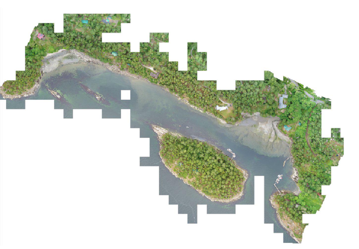
Figure 2. Drone ortho-imagery of Xetthecum (Retreat Cove) shoreline